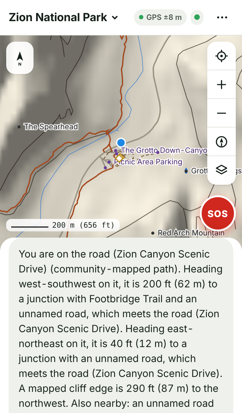
Where am I
The trail you're on, which way you're heading, and how far it is each way to the next junction or road.
Free hiking app for your phone
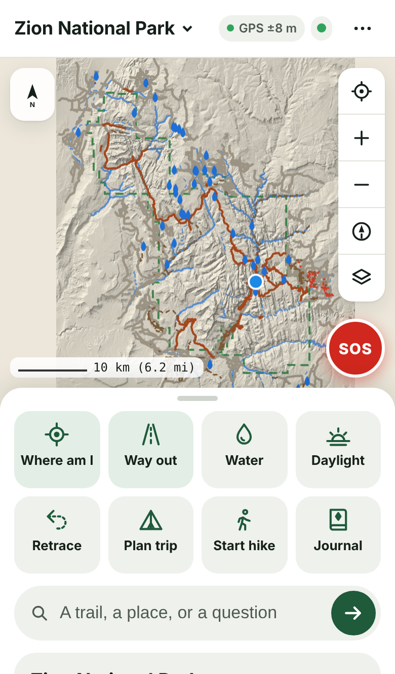
TrailTruth keeps official park maps on your phone. Ask where you are, the way out, where the water is, or when it gets dark. It answers from that data.
It installs from this page like an app: its own icon on your home screen, full screen, and it works offline.
No Share button or ⋮ menu? The link opened inside another app, such as a chat or email app. , then paste it into Safari or Chrome.
Then, while you still have signal, open a park in the app so its map is saved for the trail.
By using TrailTruth you agree to the terms and the privacy policy.
The trail you're on, which way you're heading, and how far it is each way to the next junction or road.
The shortest way back to a road or trailhead, with distance, climb and time, and an arrow that points the way.
Mapped springs, streams, lakes and water taps near you, and whether a stream runs all year or only in some seasons. It can't tell you if water is flowing today.
Sunrise, sunset, when it gets too dark to see the trail, and how many minutes of light you have left.
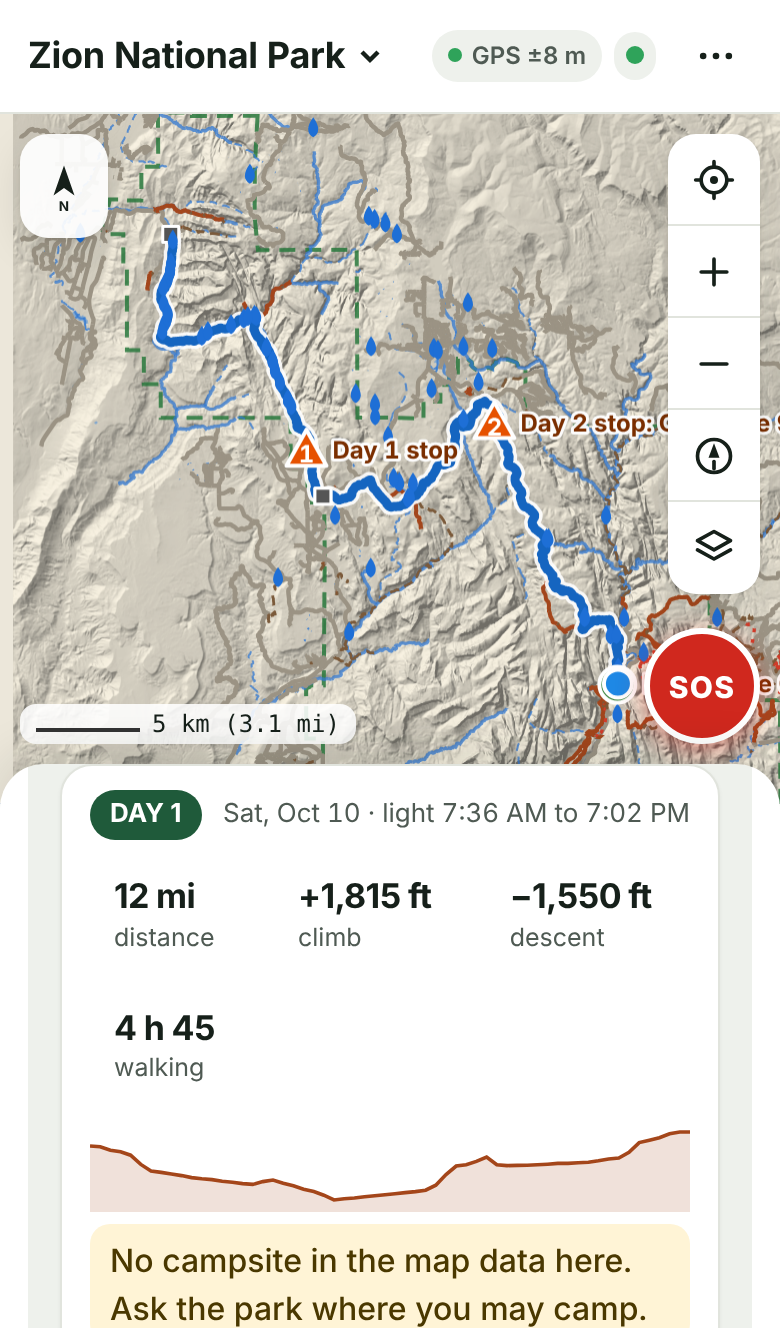
Day-by-day legs, camps, water and exits for an out-and-back, a point-to-point or a loop, with the weather forecast for each day when you have signal.
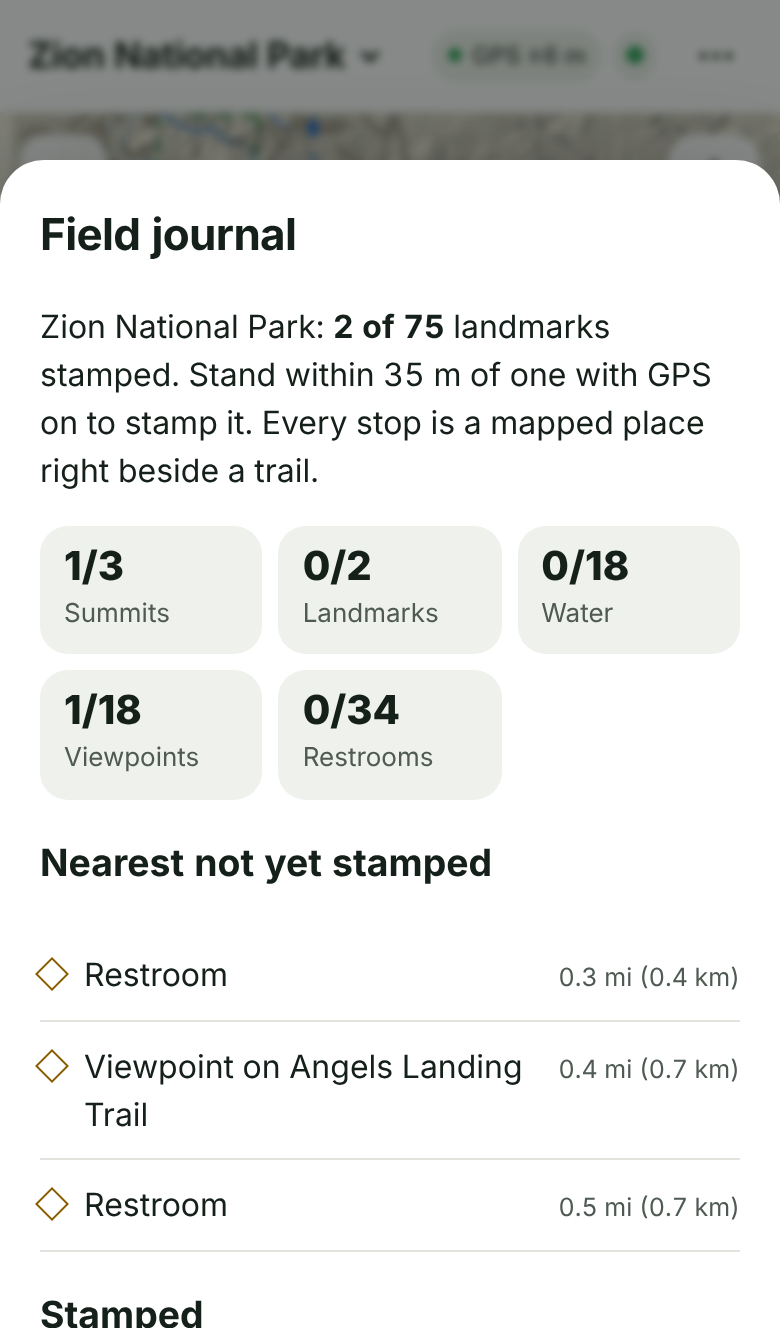
Walk up to real summits, lakes, waterfalls and viewpoints along the trail to stamp them in your journal. Earn achievements for summits, miles, climb and steps, all measured by your phone.
USGS satellite photos, and a map that turns to face the way you're facing.
One tap shows your exact coordinates to read to 911, the nearest places rescuers can reach, and buttons to call or text 911.
These are real rescues, each reported by a rescue team, a sheriff or a news outlet quoting them. In each one, hikers trusted a chatbot or a street-map app that was never built for the backcountry.
Mount Shasta, California · reported Sept. 3, 2026 · Google Gemini
Three hikers told the sheriff they relied heavily on Gemini for the route and what to pack. The sheriff said Gemini advised them to bring far less food and water than they needed. They reached the summit at 7 p.m., seven hours after the noon turnaround, wandered off route into Mud Creek Canyon in the dark, and spent the night out with a knee injury until Forest Service climbing rangers reached them.
What TrailTruth does instead. It never tells you how much food or water to carry. It shows the mapped water along your route and says plainly when a day has none. Walking times come from distance plus the climb in USGS elevation data, and it warns you when the walking runs longer than the daylight. It says when the sun sets where you are standing.
Source: ABC7, Siskiyou County Sheriff
Tatra Mountains, Poland · July 4, 2026 · ChatGPT
Two hikers asked ChatGPT for a shortcut to the Five Lakes Valley. It sent them over the Świnicka Ławka crossing, and they got stuck in climbing terrain on a north face. The Tatra rescue service (TOPR) flew them out by helicopter.
What TrailTruth does instead. It routes you along mapped trails only. Ask which way a place is and it gives the distance by trail, not just a straight line. If you are off trail, it tells you when the straight line back to the trail crosses a mapped cliff and says not to take it.
Source: TOPR weekly report
Crown Mountain, British Columbia · October 2026 · an AI-planned route
A 16-year-old followed an AI route up Crown Mountain by a gully and got stuck at the base of a cliff. North Shore Rescue reached him. Their search manager said: “You can’t just blindly follow what AI is proposing to you.”
What TrailTruth does instead. It will not tell you a route is easy or safe for you. Ask how hard a hike is and it says the map data has no difficulty ratings and to ask a ranger, then gives you the facts it does have: the trail's length and how much it climbs.
Source: MobileSyrup
Howe Sound Crest Trail, British Columbia · July 15, 2026 · Google Maps
Google Maps told three teenagers the trip would take 5 hours and 13 minutes. The hike takes 8 to 14 hours and is often a two- or three-day trip. One of them fell and was airlifted out. Google said its walking directions are designed for streets.
What TrailTruth does instead. It is built for trails. Times count the climb (1 hour for every 600 m up, on top of 5 km/h), are labelled as a rule of thumb without breaks, and the planner warns when a day is longer than its daylight.
Source: The Narwhal
Mount Fromme, British Columbia · 2023 · Google Maps
North Shore Rescue said people kept getting lost on Mount Fromme because Google Maps showed a trail that does not exist. One hiker had to be lifted off a cliff by helicopter.
What TrailTruth does instead. Its trails come from the National Park Service and USGS. Paths that come from community mapping (OpenStreetMap) are labelled as not official park trails whenever a route uses them, so you know which lines to trust less.
Source: The Narwhal
Causey Pike, Lake District, England · January 2, 2023 · AllTrails
A walker took a shortcut shown on AllTrails as it got dark and could not find the path. Keswick Mountain Rescue’s log says: “There is no path in this location, the mapping software was incorrect.” They guided him out by phone.
What TrailTruth does instead. The map, your position, the way out and the emergency screen all work with no signal, because the whole park is on your phone. The way out is the shortest mapped route back to a road or trailhead from where you stand.
Source: Keswick MRT incident log
What TrailTruth can't do: it can't see snow, ice, storms or a washed-out bridge, and it doesn't know how fit you are. When you ask about those it says it doesn't know, and with signal it shows the National Weather Service alerts and the park's own alerts.
Not your only navigation. Carry a paper map and compass, tell someone your plan, and check the park's alerts before you go.